Calico Tanks Trail: What to Know Before You Go
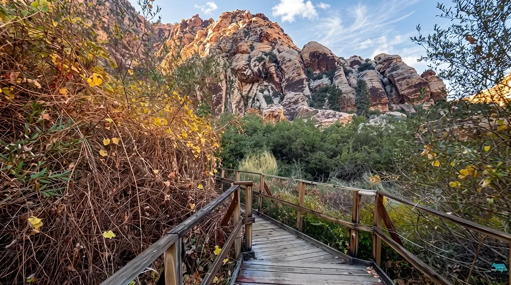
Two miles round trip. Ninety minutes, give or take. That's all it takes to earn one of the best views in Red Rock Canyon — a wide-open panorama of the Las Vegas valley, framed by red rock you'll climb with your own hands to reach. Calico Tanks packs a genuine scramble, colorful sandstone corridors, and a hidden natural rock basin into a trail short enough to squeeze into a single morning, yet satisfying enough that most hikers rank it above trails twice its length. It's the hike locals send visitors on when there's only half a day to spare but everyone still wants to feel like they earned the view. Welcome to Red Rock Canyon National Conservation Area. If this is your first visit and the Calico Tanks Trail is on your itinerary, this guide will help you enjoy one of the park's most popular short hikes — one that combines light scrambling, colorful sandstone, and the chance of a seasonal water feature with distant city views.
Trail Snapshot
Distance | Approximately 2.2 miles round trip
Elevation Gain | About 390 ft
Highest Point | Roughly 4,720 ft
Hike Time | 1.5 to 2 hours
Difficulty | Moderate
Trailhead | Sandstone Quarry parking area (3rd major lot on Scenic Drive)
Fee | $20 per vehicle, or America the Beautiful Pass
Reservations | Required for Scenic Drive entry Oct 1–May 31, 8am to 5pm (free, via recreation.gov); not required June 1–Sep 30, or outside those hours any time of year
Restrooms | At the trailhead
Pets | Allowed, must be leashed
Map | Download Map
How to Reach the Trailhead
The trail begins at the Sandstone Quarry parking area, about three miles into the Red Rock Scenic Drive — the third major lot along the loop. Restrooms, maps, and clear signage are available at the trailhead, and the lot itself is easy to find and generally well marked. This is also the starting point for Turtlehead Peak, so don't be surprised to see hikers splitting off in two directions right from the parking lot.
A park entrance fee of $20 per vehicle or an America the Beautiful Pass is required. Between October 1 and May 31, timed-entry reservations are needed to access the Scenic Drive between 8 a.m. and 5 p.m. — reserve online at recreation.gov before you go. Entry before 8 a.m. or after 5 p.m. does not require a reservation, and no reservation is needed at all from June through September. There's nothing to eat at the trailhead beyond the restrooms, so pack your own snacks and water — plenty of casual dining options wait back along the drive into Las Vegas once you're off the trail.
What to Expect on the Trail
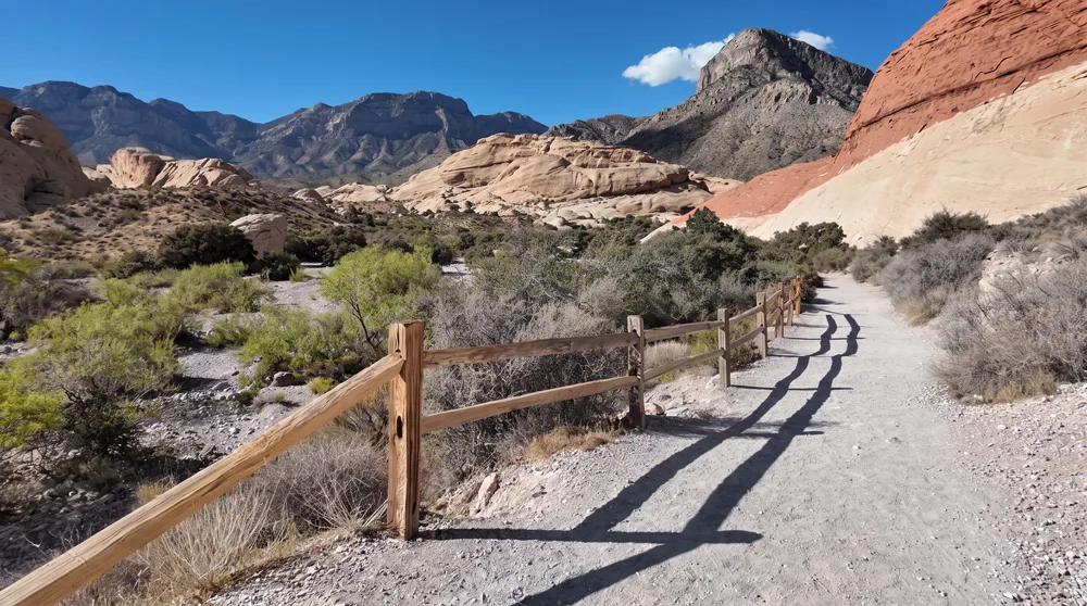
The first section is relatively flat and sandy, framed by bold red rock formations. Shortly after leaving the quarry area, a wide rocky wash appears. The correct trail cuts left of the wash and reconnects shortly afterward. At the next signed junction, stay right for Calico Tanks (Turtlehead Peak continues left).
Beyond the junction the terrain becomes more varied. The path threads through narrow sandstone corridors, climbs carved stone stairs, and includes short sections of light scrambling. Grippy footwear is recommended, and if you're not used to hand-and-foot scrambling, a light pair of gloves can make the rougher sandstone sections more comfortable. On a typical day the route remains non-technical, though wet sandstone should be avoided for 24 hours after rain, as it becomes slippery and more fragile.
Just before the tanks, the trail opens into a wide rock bowl — a natural amphitheater view over the valley that's worth a pause before committing to the final scramble. At approximately 1.1 miles you reach the "tanks" themselves — natural sandstone basins that collect water after rain or during wetter periods. The tanks may appear as a reflective pool or a dry depression depending on recent weather, and even dry, the surrounding rock formations frame the basin well for photos. This is the official end of the maintained trail.
For the best viewpoint, continue a short distance up and to the right of the tanks along a faint path. On clear days this overlook reveals the Las Vegas Strip across the horizon. Retrace your steps to return to the parking area.
The Sandstone Behind the Scramble
The layered red and white rock you're climbing through is Aztec sandstone, the same cross-bedded formation that colors much of Red Rock Canyon — its swirling bands are the fossilized remains of ancient sand dunes, later stained unevenly by iron oxide working its way through the layers over millions of years. There's no interpretive signage on the trail itself explaining any of this, so if you want the context, the visitor center near the park entrance covers the geology in more depth, either before you set out or on your way back through.
Best Time to Visit and Conditions
Spring or periods following recent rain offer the best chance of water in the tanks. Early morning starts provide cooler temperatures and more shade from the surrounding rock, and weekday mornings in particular help you avoid bottlenecking with other hikers at the tighter scramble sections near the top. The trail is fully exposed and can become uncomfortably, even dangerously, hot in summer, given there's essentially no shade and no water source once you leave the trailhead. The park stays open year-round, but fall through spring is genuinely when this trail is at its best. Crowds are common, especially mid-morning and on weekends; arriving early helps avoid congestion at both the parking lot and the scramble itself.
Practical Advice for New Visitors
- Carry more water than you think you'll need; shade is limited to nonexistent for most of the route.
- Wear shoes with good traction suitable for rock and light scrambling; consider light gloves if you're not used to scrambling with your hands.
- Sun protection (hat, sunscreen, sunglasses) is essential.
- Stay on the marked route and follow signed junctions carefully.
- Cell service is unreliable; do not rely on rideshare services for drop-off or pickup inside the park.
- Check current conditions, especially after rain, before attempting any sandstone climbs.
- If bringing kids, this trail is best suited to those confident scrambling over rocks on their own — pack snug-fitting closed-toe shoes and a water bottle just for them, and set a turnaround point before the steepest section.
- If bringing a dog, keep them leashed and think twice in summer — hot sandstone is tough on paw pads, and this is much more of a cooler-season dog hike.
Clear nights make this a decent, low-light-pollution stargazing spot for those willing to hike out after dark with proper lighting.
Calico Tanks Trail delivers an engaging introduction to Red Rock Canyon's sandstone landscape in a compact package. With attention to timing, footwear, and basic safety practices, first-time visitors can enjoy the corridors, seasonal tanks, and optional Strip viewpoint in a safe and memorable outing. Stay on the trail, leave no trace, and enjoy the park.