Cowboy Trail: What to Know Before You Go
Cowboy Trail — officially BLM Trail 200 — shares its starting point with LvLocal's Petroglyph Canyon Trail guide, splitting off partway in to climb toward a scenic saddle before looping back to the same trailhead. It's popular specifically as the easier alternative to the rocky scrambling and narrows on the main Petroglyph Canyon route, and unlike much of the broader Sloan Canyon trail network, bicycles are explicitly prohibited here. Welcome to Cowboy Trail, a genuine hiking-only option for visitors who want the saddle views without the technical scrambling.
Before You Go: The trail's permanent trailhead and access road, Nawghaw Poa Road, are closed for construction of a new visitor contact station through November 11, 2026. Hiking access is temporarily rerouted through Democracy Drive in Henderson — check the BLM's Sloan Canyon NCA page for current access details before you go.
Trail Snapshot
Distance | Approximately 4.3 miles round trip for the full Petroglyph Canyon + Cowboy Trail loop (the Cowboy segment itself is roughly 0.75 miles)
Elevation | Climbs from around 2,954 ft at the trailhead to a saddle around 3,306 ft
Difficulty | Moderate
Hike Time | 2 to 3 hours
Fee | None
Restrooms | Not confirmed at the current construction-era access point
Pets | Not allowed
Elevation | Climbs from around 2,954 ft at the trailhead to a saddle around 3,306 ft
Difficulty | Moderate
Hike Time | 2 to 3 hours
Fee | None
Restrooms | Not confirmed at the current construction-era access point
Pets | Not allowed
How to Reach the Trailhead
Cowboy Trail shares its trailhead with LvLocal's existing Petroglyph Canyon Trail guide — see that guide for full driving directions. The permanent Nawghaw Poa Road trailhead is closed for construction through November 2026, with hiking access temporarily rerouted via Democracy Drive in Henderson. There's no fee to hike here, but confirm the current access route on BLM's website before you drive out.
What to Expect on the Trail
Cowboy Trail splits off the main Petroglyph Canyon route roughly 1 to 1.7 miles in (sources vary slightly on the exact split point), following a wash before climbing a built switchback trail to a saddle — genuinely steeper than it first appears — then descending back to the main canyon to complete the loop. It's specifically favored by locals as the easier bypass around the rockier scrambling and dry-fall obstacles on the direct Petroglyph Canyon route. Bicycles are explicitly prohibited here.
A Hiking-Only Bypass With Its Own Saddle Views
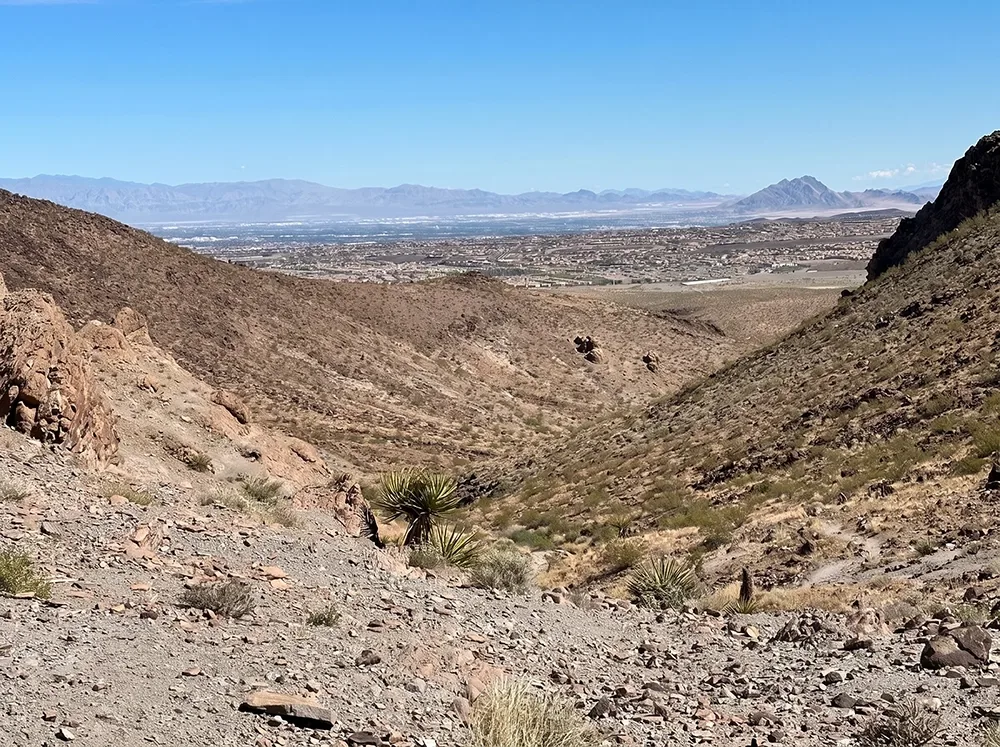
Broad views north over the Las Vegas Valley and south toward the surrounding wilderness peaks open up from the saddle — a different payoff than the petroglyph panels themselves, which are concentrated on the main Petroglyph Canyon Trail route this loop connects back into. This trail is part of the same Sloan Canyon NCA system as that culturally significant rock art site, more than 300 panels and roughly 1,700 individual design elements documented by the BLM — see LvLocal's Petroglyph Canyon Trail guide for the full history, since this route is typically hiked in combination with it rather than on its own.
Best Time to Visit and Conditions
October through May is the reliable window — summer heat in this exposed canyon regularly exceeds 110°F with no shade anywhere on the route.
Practical Advice for New Visitors
- Bring at least 2 to 3 liters of water per person.
- Wear sturdy shoes for the switchback climb.
- Pack sun protection — there's no shade.
- Download an offline map, since access is temporarily different from normal.
- This is the easier bypass for hikers who want to skip the narrows scrambling on the direct Petroglyph Canyon route.
- Bicycles are explicitly prohibited here, unlike much of the broader Sloan Canyon network.
- Check BLM's Sloan Canyon page for the current Democracy Drive reroute before heading out.
- Leave dogs at home — pets aren't allowed in this area.
For hikers who want to see Petroglyph Canyon's rock art but skip the narrows scrambling on the way back, Cowboy Trail is a genuinely useful, hiking-only loop-return option from the same trailhead.