Fire Wave Trail: What to Know Before You Go
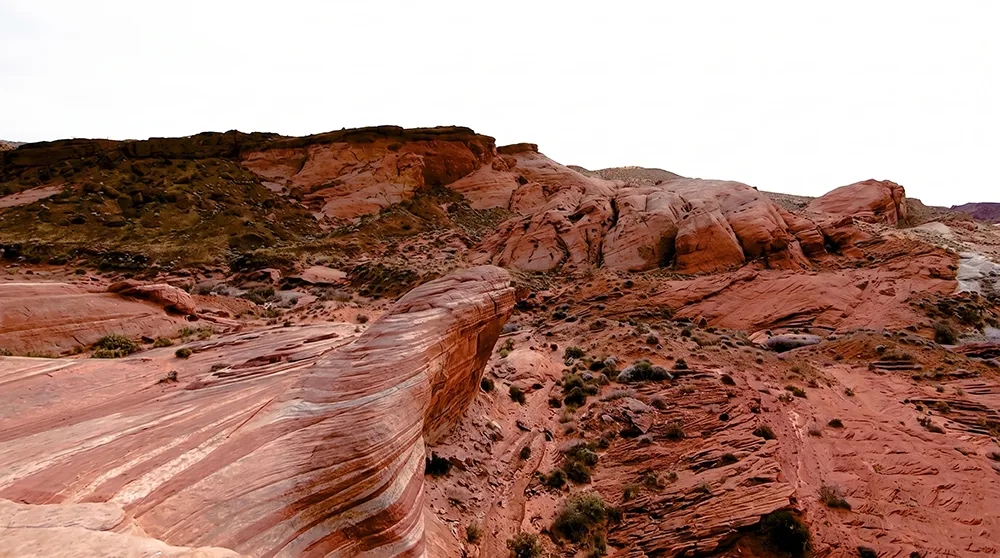
Some rock formations look like rock. The Fire Wave looks like someone dragged a paintbrush through red and white sand and let it freeze mid-stroke. It's the single most photographed spot in Valley of Fire, and for a fraction of the effort you'd expect — a compact, 1.5-mile round trip that most visitors finish, photos and all, in under two hours. Welcome to Valley of Fire State Park. If this is your first visit and the Fire Wave Trail is on your itinerary, this guide will help you prepare for a short, highly scenic hike that showcases some of the park's most distinctive sandstone formations.
Trail Snapshot
Distance | 1.5-mile round trip
Elevation Gain | Approximately 175 ft
Hike Time | 1 to 2 hours, including photo stops
Difficulty | Easy (rated "moderate" on the trailhead sign)
Fee | $10 / $15 for Non-NV Plates
Hours | Open roughly October through April; closed mid-May through September for extreme heat
Parking | Two lots off Mouse's Tank Road; smaller lot (10–15 spaces) is the actual trailhead
Restrooms | None at the trailhead — nearest vault toilets are about a mile away at White Domes
Pets | Allowed, must be leashed
Accessibility | Not wheelchair or stroller friendly
Elevation Gain | Approximately 175 ft
Hike Time | 1 to 2 hours, including photo stops
Difficulty | Easy (rated "moderate" on the trailhead sign)
Fee | $10 / $15 for Non-NV Plates
Hours | Open roughly October through April; closed mid-May through September for extreme heat
Parking | Two lots off Mouse's Tank Road; smaller lot (10–15 spaces) is the actual trailhead
Restrooms | None at the trailhead — nearest vault toilets are about a mile away at White Domes
Pets | Allowed, must be leashed
Accessibility | Not wheelchair or stroller friendly
How to Reach the Trailhead
The trailhead is located near the end of Mouse's Tank Road. Parking is available on both sides of the road. The larger lot sits on the left; the trail actually begins from the smaller lot on the right, which holds only about 10 to 15 vehicles and fills quickly during sunrise and sunset hours. There are no restrooms at the trailhead itself — plan ahead, since the nearest vault toilets are roughly a mile farther down the road at the White Domes parking area. Cell service is spotty to nonexistent out here, so download offline maps or GPS tracks before you leave Las Vegas.
What to Expect on the Trail
From the parking area, the path begins as a sandy trail heading toward tall red rock cliffs. At the base of the cliffs, turn right and follow the wooden poles marked with reflective yellow strips southeast. The route circles a cluster of large boulders with a gentle rise, then descends slightly into a narrow sandy path through a shallow valley.
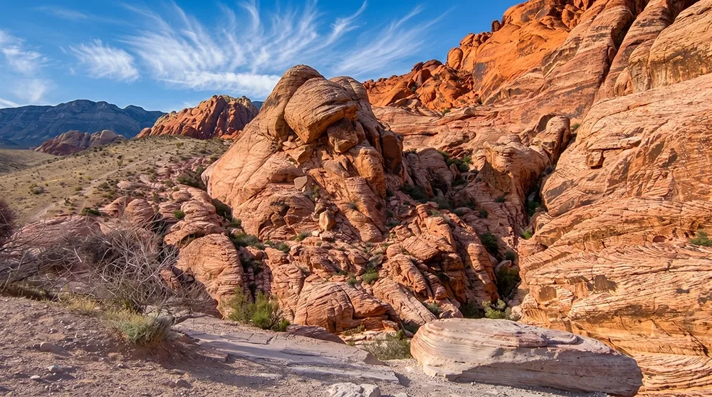
The surface transitions to hard red rock in a wide, open area. Continue following the marker poles carefully — the rock can look uniform enough in places that it's easy to lose the route without them. As you approach the final stretch, the formations take on swirling, candy-like patterns. Climb the smoothly sloping red rock face (sometimes called "the hump") one last time. Cresting this rise brings you into the Fire Wave itself — layered red and white sandstone that curves around dome-shaped formations in wave-like patterns, the product of ancient cross-bedded sand dunes and iron oxide that stained the layers unevenly over time.
Allow extra time at the Fire Wave to walk the contours and take in the colors and textures from multiple angles — shooting the formation at an angle, rather than straight on, tends to bring out the strongest color contrast. The area is at its most photogenic in soft, low-angle light and remains one of the park's most memorable short destinations. If you're serious about photos, pack a spare camera battery; between the drive, the hike, and the inevitable "just one more angle," it's easy to burn through one faster than expected.
Optional Extension: The Seven Wonders Loop
From the Fire Wave, it's possible to continue on foot to Pink Canyon, or to fold the Fire Wave into the longer Seven Wonders Loop, which visits several other formations before returning to the same trailhead. Highlights along the full loop include Fire Cave, a natural rock hollow with completely different framing than the main event; Kaolin Slot Canyon, a narrow passage with its own texture and light; and quicker stops at Striped Rock and Crazy Hill, both worth the extra few minutes if you're chasing variety in your photos. Both extensions add scenic range if time and energy allow, without requiring any technical hiking skill.
Best Time to Visit and Seasonal Closures
The trail is open roughly October through April. It is closed from May through September due to extreme heat and the associated safety risks — there is zero natural shade anywhere along this route, and the exposed rock and sand radiate heat back at hikers well beyond the air temperature alone.
Weekday mornings, especially around sunrise, from November through February generally offer the most comfortable temperatures, fewer visitors, and the best low-angle light for photos. Arrive right at sunrise if you want the Fire Wave to yourself; by mid-morning on weekends, it's common to find a small line of people waiting to take the same photo. Sunset offers nearly as good light but tends to draw even bigger crowds, since it's easier to time around a day trip from Las Vegas. Weekends and holiday periods are busier in general, and March, April, September, and October see higher visitation as temperatures warm on either side of the closure window. Always check current park conditions before your visit, since exact closure dates shift slightly year to year.
Practical Advice for New Visitors
- Carry more water than you expect to need — at least a gallon per person — since the entire route is exposed with no shade.
- Wear sturdy shoes with good tread, suitable for sand and uneven rock.
- Start early to avoid midday heat and larger crowds when the trail is open; sunrise is the sweet spot for both.
- Bring a wide-brim hat and high-SPF sunscreen even on cooler days — there's nothing out here to block the sun.
- Follow the yellow-striped marker poles and stay on the established route, especially through the sections of hard red rock where the path can be easy to lose.
- Plan restroom stops in advance, as none exist at the trailhead.
- Download offline maps before you leave, since cell service disappears well before you arrive.
The Fire Wave Trail delivers an outstanding introduction to Valley of Fire's vibrant sandstone landscapes in a compact, accessible package. With attention to seasonal closures, heat precautions, and basic preparation, first-time visitors can enjoy a safe and memorable experience. Stay on the trail, leave no trace, and enjoy the park.