Hamblin Mountain: What to Know Before You Go
Hamblin Mountain is part of the ancient Hamblin-Cleopatra Volcano, and the mountain itself is literally split in two by the Hamblin Bay Fault running directly through its middle — a real geological story, not just scenery. Reaching the 3,312-foot summit means following a maze of washes for roughly 6.6 to 7.1 miles round trip, past rich red sandstone cliffs and multicolored mudstones, with a couple of short scrambling sections near the top. Welcome to Hamblin Mountain, a genuine off-trail objective with one of the best geology stories in this whole series.
Trail Snapshot
Distance | 6.6-7.1 miles round trip via Cottonwood Wash
Elevation | ~1,440-1,453 ft cumulative gain (3,312 ft summit elevation)
Difficulty | Strenuous (off-trail, some scrambling)
Hike Time | 4 to 6 hours
Fee | $25 per vehicle (1-7 day pass), $15 per person pedestrian/cyclist, $45 annual pass — cashless, card only
Restrooms | Not confirmed at the trailhead
Pets | Standard park-wide leash policy (6 ft max) applies
Elevation | ~1,440-1,453 ft cumulative gain (3,312 ft summit elevation)
Difficulty | Strenuous (off-trail, some scrambling)
Hike Time | 4 to 6 hours
Fee | $25 per vehicle (1-7 day pass), $15 per person pedestrian/cyclist, $45 annual pass — cashless, card only
Restrooms | Not confirmed at the trailhead
Pets | Standard park-wide leash policy (6 ft max) applies
How to Reach the Trailhead
The trailhead is an informal spot just beyond mile marker 18 on Northshore Road, about 15 miles from the Lake Mead Boulevard intersection — a different access point than Callville Summit's trailhead near the campground. Lake Mead National Recreation Area's entrance fee ($25/vehicle) applies.
What to Expect on the Trail
This is genuinely off-trail hiking through a maze of washes with multiple junctions requiring real navigation, crossing a small ridge before reaching the base of the peak. The final approach through a box canyon to the summit involves a couple of short scrambling bits, with the top section described as jagged with some exposure. Real route-finding is required through the wash system — bring navigation tools.
A Volcano Split by a Fault
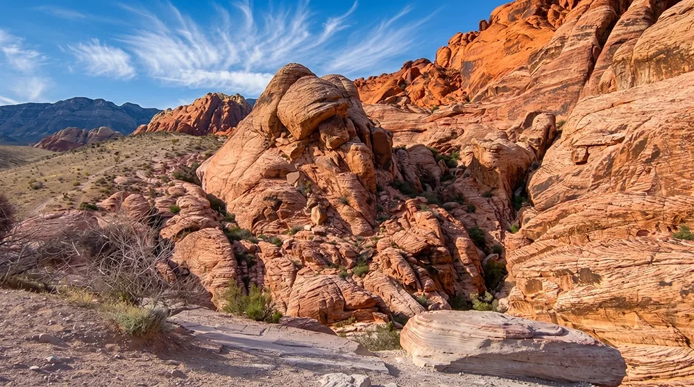
Hamblin Mountain is part of the Hamblin-Cleopatra Volcano, an ancient volcano split into three sections by fault lines — the Hamblin Bay Fault runs directly through the middle of the mountain, splitting it in two. The route passes rich red sandstone cliffs and multicolored mudstones, plus dry falls at Cottonwood Springs. The mountain is likely named for Jacob Hamblin, a 19th-century Mormon missionary and explorer active across southern Utah, southern Nevada, and northern Arizona, though no source definitively confirms this connection — treat it as a probable, not certain, naming origin. From the summit, Lake Mead dominates the view, with sightlines to Muddy Mountain High Point, Muddy Peak, Sentinel Peak, Pyramid Peak, Booth Pinnacle, and Razorback Ridge.
Best Time to Visit and Conditions
Fall through spring is most comfortable given the length and exposure of this route.
Practical Advice for New Visitors
- Bring at least 3-4 liters of water per person given the distance.
- Download a GPS track or offline map — genuine wash-navigation is required.
- Wear sturdy hiking boots for scrambling near the summit.
- Plan for a full day given the length and remoteness.
- Start early given the length of this route.
- Not appropriate for children given the distance and summit scrambling.
- This is a serious objective requiring real navigation skill.
- The final scramble section has genuine exposure — not for beginners.
For experienced off-trail hikers who want a genuine geological story along with real summit views, Hamblin Mountain is one of the most rewarding strenuous objectives near Lake Mead. Navigate the washes carefully, respect the exposure near the top, and take in one of the best panoramas in the park.