Mary Jane Falls Trail: What to Know Before You Go
Picture this: you left the Strip an hour ago, and now you're standing under real pine trees, listening to actual running water, in air that's a full 20 degrees cooler than the valley floor you just escaped. That's Mary Jane Falls — 35 miles and a whole different climate away from the casino lights. It's the most popular hike in the Spring Mountains for good reason: on a busy summer day the trail has hosted upwards of 10,000 people, all chasing the same thing — a hidden amphitheater of limestone cliffs, a secret cave, a rock alcove tucked right behind the falls, and a waterfall named for a little girl who once spent her summers on this mountain. No entrance fee, no tour buses, just a genuine sky-island forest that feels like it doesn't belong within an hour of the desert. Here's everything you need to know to make the most of it, when to go, and — most importantly right now — whether you can go at all.
Before You Plan Anything: Current Closure Status
Mary Jane Falls Trail is closed. It has been since August 2023, when Tropical Storm Hilary tore through Kyle Canyon and left long stretches of the trail replaced by erosion trenches nearly 10 feet deep in places. The U.S. Forest Service closed the trail, the trailhead, and the parking area, and that closure remains in effect today.
Reconstruction crews began work in 2026, rebuilding the trail itself and repairing the Trail Canyon and Mary Jane parking lots. The project has taken years to get moving in part because the route crosses archaeological sites and sensitive species habitat, which requires extensive environmental review before any repair work can start. As of now, the Forest Service's estimated reopening is fall 2027, pending completion of both the trail and the parking area.
Until then, entering the closure zone is prohibited under an active Forest Closure Order, and construction crews and heavy machinery are actively working in the area. Do not attempt this hike based on old trip reports, GPS tracks, or trail apps — several third-party sites still show it as open. Check the Spring Mountains National Recreation Area's current conditions page or call the Ranger Station before making the drive. The rest of this guide describes the trail as it exists so you can plan ahead for when it reopens, and recognize it if you're hiking nearby routes in the meantime.
Trail Snapshot
Status | Closed since August 2023; estimated reopening fall 2027
Distance | 1.6 miles one way / 3.2 miles round trip
Hike Time | Roughly 2.5 to 3 hours round trip
Trailhead Elevation | Approximately 7,706 ft
Elevation at the Falls | Approximately 8,800 ft
Difficulty | Easy to moderate
Location | Upper Kyle Canyon, Spring Mountains National Recreation Area
Amenities | Parking lot and vault toilet at the trailhead (currently closed)
Fee | None
Pets | Normally allowed on leash
Peak Popularity | Over 10,000 visitors in a single day during peak season
A note on trip planning: some third-party trail sites and apps still list this hike as open with generic seasonal hours. They're out of date — rely on the U.S. Forest Service's current conditions page or a phone call to the Ranger Station, not app listings, for the real status.
How to Reach the Trailhead (When Open)
From Las Vegas, take US-95 North to NV-157 and follow the signs toward Mount Charleston. Continue along NV-157 as it climbs steadily for a little over 20 miles. Near the end of the route, turn right onto Echo Road, following signs for Mary Jane Falls and Trail Canyon. Continue on Echo Road, which eventually turns to graded gravel, to the Trail Canyon parking lot, then follow the connecting dirt road to the Mary Jane Falls parking area.
Under normal conditions, this is the busiest trailhead in the Spring Mountains, with a sizable gravel lot, primitive restrooms, and an information board. Even before the closure, the lot filled quickly on weekends — arrivals before 7 a.m. commonly found fewer than ten cars, while the same lot was full just two hours later.
Trail Overview and What to Expect
Once reopened, Mary Jane Falls will remain an out-and-back hike of 1.6 miles one way, gaining a little over 1,000 feet from trailhead to falls. The first stretch, roughly seven-tenths of a mile, follows a wide, well-defined, gently ascending path through towering ponderosa pine, white fir, and aspen — a genuine sky-island forest perched well above the surrounding desert floor. Earlier in spring, expect a few seasonal creek crossings along this stretch, fed by the same snowmelt that will eventually feed the falls. At a signed junction, the route turns and begins climbing a series of switchbacks — historically nine of them — for the remaining nine-tenths of a mile. This upper section is narrower, steeper, and more prone to erosion, which is precisely the terrain that sustained the worst damage during Tropical Storm Hilary.
As you ascend, views open steadily down the length of upper Kyle Canyon. Look for Charleston Peak, Griffith Peak, Cathedral Rock, and the sheer limestone cliffs that define the canyon's upper reaches — each switchback reveals a little more of the valley below.
Near the falls, a short detour of a couple hundred feet south along the base of the cliffs leads to a small cave, framing a view back down the canyon. It's an easy add-on that most first-time visitors count among the highlights of the hike.
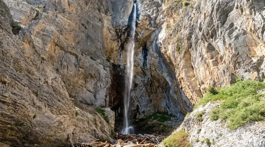
The falls themselves are fed by two springs that cascade down terraced limestone cliff walls into a natural amphitheater. They flow year-round, but volume swings dramatically with the season — visit in early spring, when snowmelt peaks, and you'll find genuine cascades; visit in late summer and you may find damp rock instead of a waterfall. Big Falls, a second and reportedly more dramatic cascade nearby, is sometimes visible from the trail early in the season, though it typically dries up sooner than Mary Jane.
Tucked directly behind the waterfall is a small rock alcove, a favorite spot for photos and light scrambling. The footing there is slick and uneven even when the falls are running well, so treat it as a bonus for confident hikers rather than a required stop — trekking poles are a real asset if you plan to explore it.
A Trail With Its Own History
The waterfall's name has nothing to do with the movies or the plant — it's a family story. In the early 1900s, E.W. Griffith, a Canadian immigrant who came to Las Vegas to work on the Union Pacific Railroad, founded the Mount Charleston Park resort with his son in 1915. He later named the falls after his granddaughter, Mary Jane, who spent many childhood summers on the mountain. Griffith Peak, visible from the trail, carries the family name as well.
The mountain the falls sit on has an older name of its own. In the Southern Paiute language, Mount Charleston is known as Nuvagantu, meaning "where snow sits" — a fitting description for a peak that holds snow roughly half the year and is visible even from parts of the Las Vegas Strip. The Spring Mountains are the ancestral homelands of the Southern Paiute, Chemehuevi, and Western Shoshone peoples, and the Mary Jane Falls corridor itself passes through recognized archaeological sites, part of why its post-storm repair has required such extensive review.
The mountain also carries a somber piece of Cold War history: in 1955, a CIA Military Air Transport Service plane crashed into Charleston Peak during a blizzard, and wreckage from that crash has been found in the area for decades since — a reminder that this range has quietly witnessed more than a century of Southern Nevada's history, long before it became a weekend hiking destination.
Best Time to Visit (Once Reopened)
Mid-to-late spring, April through May, will remain the recommended window. Earlier in the season, lingering snow drifts can block sections of the trail, and the switchbacks can be genuinely hazardous when icy. Later in the year the falls often diminish to a trickle. Summer temperatures at this elevation can still approach 100°F on hot years, so extra caution with heat, hydration, and timing will matter even at nearly 9,000 feet.
Practical Advice for Future Visitors
- Confirm the trail has reopened and check current conditions before making the drive — do not rely on trail apps or older trip reports.
- Wear sturdy footwear suited to rocky, loose, and possibly snowy or muddy switchbacks.
- Carry sufficient water (at least 2 liters per person) and sun protection; shade thins out considerably above the tree line, and the forest canopy lower down isn't enough to skip sunscreen.
- Aim for a weekday morning if you can — this has historically been the busiest trailhead in the Spring Mountains, and weekday visits mean a real shot at parking and a quieter trail.
- Stay on the established trail and avoid cutting switchbacks, which is what caused much of the erosion that led to this closure in the first place.
- If you plan to explore the rock alcove behind the falls, bring trekking poles and keep close supervision on kids or unsteady hikers — the footing there is slick even in good conditions.
- Allow time for the short detour to the cave and to take in the expanding canyon views along the way.
Mary Jane Falls has long offered a compact introduction to the Spring Mountains' scenery, elevation, and seasonal water features — dramatic canyon views, a reliable snowmelt waterfall, and a hidden cave, all within a three-hour round trip. Right now, the best way to respect that trail is to stay off it until repairs are complete. When it reopens, plan your visit for spring, come early, and treat the mountain's long history — geological, cultural, and personal — with the same care its name reflects.