Pinnacles Loop: What to Know Before You Go
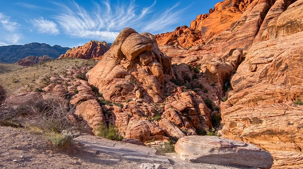
Pinnacles Loop earns its name honestly — a genuine cluster of sandstone spire formations, described by one hiker as a sandstone jungle, reached via a moderate loop of roughly 4.5 to 4.9 miles. It shares its trailhead with Atlatl Rock, and bighorn sheep sightings are a real possibility along the way. Like several other Valley of Fire trails, it closes every summer for heat safety — worth knowing before you plan a trip. Welcome to Pinnacles Loop, one of the park's more adventurous moderate hikes once the season allows it.
Before You Go: This trail is closed annually from May 15 through September 30 for heat safety, along with several other Valley of Fire trails. It reopens around October 1. Check parks.nv.gov for current status before you go.
Trail Snapshot
Distance | Approximately 4.5–4.9 miles (sources vary slightly)
Elevation Gain | ~423–436 ft
Difficulty | Moderate
Hike Time | 2 to 2.5 hours
Fee | $10 per vehicle (Nevada plates), $15 per vehicle (non-Nevada)
Restrooms | Yes, at the Atlatl Rock Picnic Area
Pets | Not explicitly confirmed
Elevation Gain | ~423–436 ft
Difficulty | Moderate
Hike Time | 2 to 2.5 hours
Fee | $10 per vehicle (Nevada plates), $15 per vehicle (non-Nevada)
Restrooms | Yes, at the Atlatl Rock Picnic Area
Pets | Not explicitly confirmed
How to Reach the Trailhead
Start from the Atlatl Rock Picnic Area, which has restrooms, grills, and an RV dump station with drinking water — the only water source before you're on the trail itself. Standard Valley of Fire entrance fee applies.
What to Expect on the Trail
Unlike Fire Wave's well-marked pole system, Pinnacles Loop is described as faint and poorly marked with minimal signage — a real navigation caution, not just generic difficulty. Terrain includes loose rock, sand, and cactus, winding through a cluster of sandstone spire and tower formations that give this trail its name.
A Real Navigation Caution
Nevada State Parks closes this trail annually from May 15 through September 30 due to a documented history of medical calls, search-and-rescue missions, and fatalities during the hottest months. Beyond the seasonal closure, the faint, poorly marked route is worth taking seriously year-round — bring real navigation tools, not just a general sense of direction.
Best Time to Visit and Conditions
Closed May 15 through September 30 every year. October through April is the accessible window, with morning starts offering the best light on the spire formations.
Practical Advice for New Visitors
- Bring at least 2 to 3 liters of water per person.
- Carry a GPS track or offline map — the route is faint and poorly marked.
- Wear sturdy shoes for loose rock and sand.
- Confirm current open status before you go.
- Watch for bighorn sheep along the route.
- Not recommended for young kids given the faint, unmarked route.
- The trail is closed May 15 through September 30 every year.
- Shares its trailhead with Atlatl Rock, worth combining both stops.
For hikers ready for a moderate loop with a genuinely different look than the park's more famous trails, Pinnacles Loop delivers. Plan around the mandatory summer closure, bring real navigation tools given the faint route, and enjoy one of the park's more distinctive rock formations.