Turtlehead Peak Trail: What to Know Before You Go
Most peaks in Red Rock Canyon demand technical skills, ropes, or a full day to reach. Turtlehead doesn't — it just demands your legs, your lungs, and a healthy respect for nearly 2,000 feet of elevation gain packed into nine-tenths of a mile at the top. Locals point to this one whenever someone calls Red Rock Canyon "just an easy scenic loop" — it's widely considered the toughest maintained trail in the park. In exchange for the effort, you get the shortest summit hike in the NCA and a 360-degree view that stretches across the Calico Hills, the Wilson Cliffs, and the Las Vegas skyline. Welcome to Red Rock Canyon National Conservation Area. If this is your first visit and Turtlehead Peak is on your list, this guide will help you prepare for one of the most popular and rewarding summit hikes in the park.
Trail Snapshot
Distance | 4.6-mile round trip
Elevation Gain | Approximately 1,988 ft
Summit Elevation | About 6,322 ft
Hike Time | 3.5 to 4.5 hours
Difficulty | Strenuous
Trailhead | Sandstone Quarry parking area (3rd major lot on Scenic Drive)
Fee | $20 per vehicle entrance fee, or America the Beautiful Pass
Reservations | Required for Scenic Drive entry Oct 1–May 31, 8am to 5pm (free, via recreation.gov); not required June 1–Sep 30, or outside those hours any time of year
Technical Difficulty | No technical climbing or special permits beyond standard entry
How to Reach the Trailhead
The trail begins at the Sandstone Quarry parking area, approximately three miles into the Red Rock Scenic Drive — the third major lot along the one-way loop. This trailhead is shared with the Calico Tanks Trail and is clearly signed. The lot is large and generally has available parking, though it fills quickly on weekend mornings; arrive after roughly 7 a.m. on a Saturday or Sunday and you may find yourself parking along the road and walking an extra quarter-mile or more just to reach the trailhead itself.
A park entrance fee or America the Beautiful Pass is required. Between October 1 and May 31, timed-entry reservations are needed to access the Scenic Drive between 8 a.m. and 5 p.m. — reserve online at recreation.gov before you go, which is one more reason an early start pays off twice over. Entry before 8 a.m. or after 5 p.m. does not require a reservation, and no reservation is needed at all from June through September.
What to Expect on the Trail
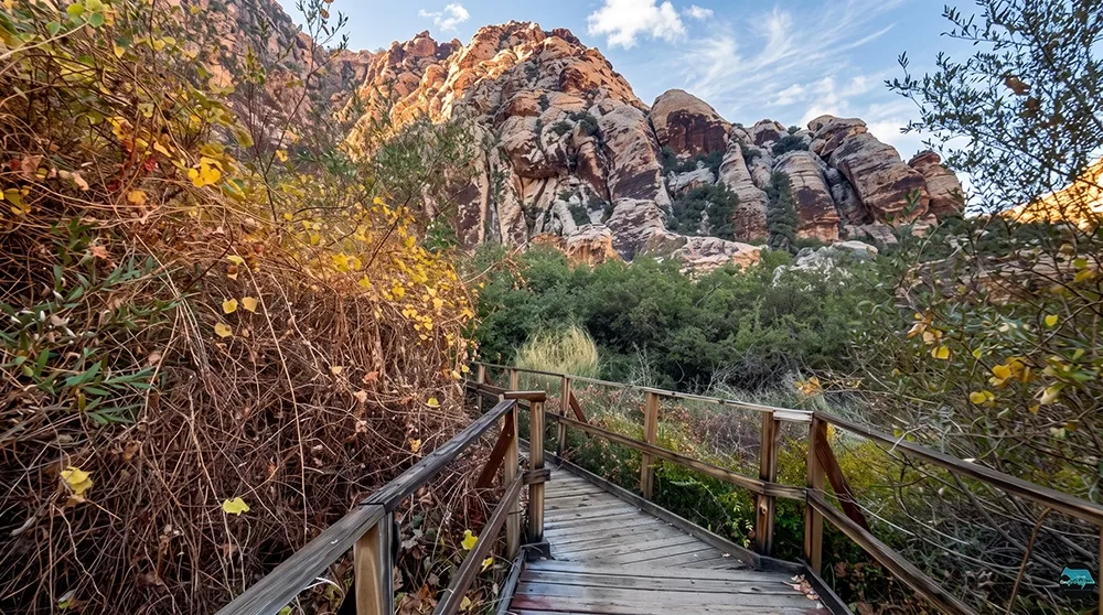
The first half-mile is relatively wide and flat, shared with the Calico Tanks Trail. At the fork, continue left toward Turtlehead Peak. Beyond this point the terrain becomes rocky, uneven, and steadily steeper. Loose gravel transitions to larger rocks, and sections require light scrambling with hands and feet.
Trail markers consist primarily of red or white painted dots and arrows on rocks rather than frequent signed posts. These can be easy to miss, particularly on the descent. Stay attentive and follow the marked route carefully; unofficial side paths often reconnect with the main trail but may be steeper or less stable than the marked route.
Elevation gain is steady and concentrated in the upper half of the climb — the vast majority of the 1,988 feet comes in the final mile and a half. Views expand quickly to include the Calico Hills, the distant Las Vegas skyline, and the shifting colors of the surrounding sandstone. Partway up, the trail crests into a bowl below the peak itself — a natural spot to catch your breath, take a photo, and size up the final push. Near the top, the trail splits again behind the peak; the more direct route continues straight up the backside, while a rockier alternate hooks around to climb from a different angle before both paths converge near the summit. At the top, you'll find a wide, rocky plateau offering true 360-degree views of Red Rock Canyon — the Calico Hills, the Wilson Cliffs, and La Madre Mountain, the highest point in the park, rising just behind you. Many hikers who make it to the top sign the small guestbook tucked at the summit, a long-standing tradition among regulars. Expect strong winds and limited shelter up there, so don't linger longer than you're prepared to stay warm.
Best Time to Visit and Conditions
October through April generally provides the most favorable conditions. Summer afternoons can be dangerously hot due to full sun exposure and high temperatures, and there is essentially no shade anywhere on the route. An early start is strongly recommended in warmer weather — in summer, that means beating the heat well before 10 a.m. Strong winds are common at the summit, so carry a windbreaker. Temperatures at the top are typically 10 to 15°F cooler than at the visitor center. Small patches of snow may linger near the summit in late fall or early winter.
Avoid sandstone surfaces for at least 24 hours after rain, as they become slippery and more fragile. Flash flooding is possible during or after storms, so check conditions before heading out if weather has been recent.
A Peak With a Formal Name
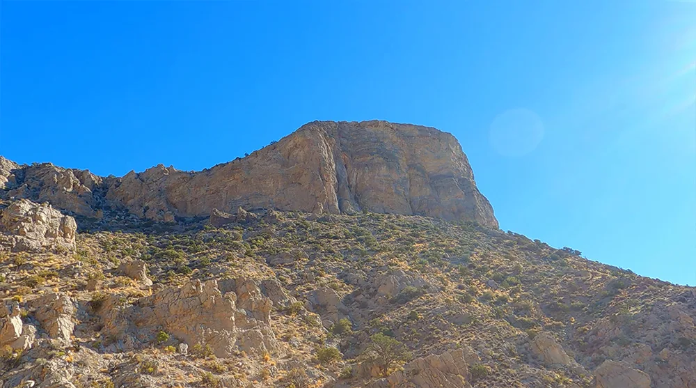
Though it's known throughout the park simply as Turtlehead Peak, the summit's official name on USGS maps is actually Turtlehead Mountain — a detached outlier of the larger La Madre Mountains, separated from the range's higher peaks by more than two miles of open desert, which is exactly why the views from the top are unobstructed in every direction. The peak is formed of greyish limestone rather than the red and white Aztec sandstone that colors much of the surrounding Calico Hills, giving it a distinctly different look and feel once you're standing on it. Red Rock Canyon itself is Nevada's first National Conservation Area, managed by the Bureau of Land Management in partnership with the nonprofit Southern Nevada Conservancy, and the broader park draws more than two million visitors a year — a fair number of whom make Turtlehead their first real summit in the range.
Practical Advice and Safety Notes for New Visitors
- Carry at least 3 to 4 liters of water per person on warm days, plus electrolytes or salty snacks — this is a longer, more exposed climb than it looks on paper, and 2 liters can run out fast on the scree sections.
- Wear sturdy hiking boots with good ankle support; some scrambling is expected, especially on loose rock near the top.
- Bring full sun protection (hat, sunscreen, sunglasses); shade is minimal to nonexistent.
- Trekking poles, a windbreaker, and an offline map or GPS are helpful, especially given how easy the painted trail markers are to lose on the descent and how loose the footing gets on the scree.
- This isn't a trail for young kids — it's best suited to older, experienced teens and adults who hike regularly. If bringing teens, set a firm turnaround time and stick to it.
- If bringing a dog, keep them leashed and check their paw pads regularly; the scree and exposed rock get hot fast in warmer months, and it's worth reconsidering the trip with a dog on the hottest days.
- Cell service is unreliable. Do not rely on rideshare services for drop-off or pickup inside the park.
- If hiking solo, inform someone of your plans.
- Stay on the marked route. Drift off-trail and the terrain can become steeper and less predictable — the unofficial side paths that reconnect with the main trail are not always the easier option they appear to be.
- Pack in a proper meal or snacks for after, since there's nothing to refuel with on the mountain — Blue Diamond or Las Vegas are your best bets once you're off the trail.
- Clear nights make the summit a legitimate (if strenuous) stargazing spot for those prepared to hike out after dark, given how dark and remote the surrounding desert is.
Turtlehead Peak offers a challenging yet highly rewarding introduction to Red Rock Canyon's high desert terrain and expansive views. With proper preparation, attention to trail markers, and respect for weather and seasonal conditions, first-time visitors can reach the summit safely and enjoy one of the park's signature panoramic overlooks. Travel prepared, stay on the trail, and leave no trace.